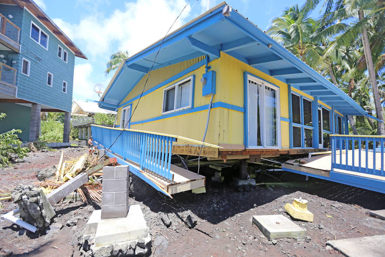
Coastal management meetings planned
HILO — Big Island residents will have the chance next week to weigh in on an ocean resources management plan, as statewide “sharing sessions” wrap up with meetings in Kona and Hilo.
Meetings are scheduled from 5:30-7:30 p.m. Wednesday at Hawaii Ocean Science and Technology Park in Kailua-Kona and 4:30-6:30 p.m. Thursday at Aupuni Center in Hilo.
“The Ocean Resources Management Plan emphasizes collaboration to address management gaps that a single agency cannot address alone and reinforces the land-sea connection, recognizing that activities on land directly impact our ocean health,” Justine Nihipali, planning program manager for the Hawaii Coastal Zone Management Program, said in an email response Friday. “The update process is important to hear ongoing and emerging issues from public input to inform the ORMP and to prioritize its actions over the next five years.”
The mission is to improve the condition of ocean resources and the coastal zone to sustain ecological, cultural, social and economic benefits for future generations. The project, overseen by the state Office of Planning, began in 2006, was formalized in 2013 and is anticipated to be completed in phases through 2030.
The purpose of the plan is to provide a framework for the protection and management of our most precious resource, the ocean surrounding us. It inter-relates important state agency responsibilities such as appropriate coastal development, watershed management, marine debris and coral reef protection.
The 2013 plan identified 11 management priorities: Appropriate coastal development, management of coastal hazards, watershed management, marine resources management, coral reef management, ocean economy management, cultural heritage of the ocean, training, education and awareness, collaboration and conflict resolution, community ocean management projects and national ocean policy and Pacific regional ocean initiative.
The agency has created a dashboard to help track progress of the initiatives at https://planning.hawaii.gov/czm/ormp/dashboard.
Shoreline public access is one measurable. Between 2012 and November, 27 new shoreline public access sites were created and 70 shoreline public access sites enhanced statewide through coastal zone regulatory requirements or acquisition with assistance from the coastal zone program, according to the Office of Planning. Opening the shoreline to the public helps ensure appropriate coastal development.
Dozens of other measurables deal with coastal mapping, climate change readiness, county coastal development plans, marine debris, invasive species and a host of other issues.
“The purpose of these information sharing sessions is to seek public input and help inform the plan’s next update,” the Office of Planning said in a statement. “The meetings will provide opportunities for attendees to share their perspectives on coastal issues, both local and statewide.”
If residents are unable to participate in an information sharing in person, an online survey is available at https://www.surveymonkey.com/r/ORMP.


