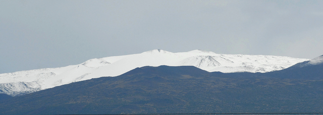
HILO — Big Island summits were capped in white once again Monday thanks to a weekend weather system that drenched just about all of the island and pushed windward rain totals above average for the year. ADVERTISING HILO — Big
HILO — Big Island summits were capped in white once again Monday thanks to a weekend weather system that drenched just about all of the island and pushed windward rain totals above average for the year.
The rain gauge at Hilo International Airport recorded 4.26 inches of rain between Saturday and Monday morning, with more than half falling Sunday. Glenwood reported 3.56 inches in the same time frame; Pahoa reported 1.66 inches and Waiakea Uka 3.92 inches.
The leeward side of the island also received a good soaking. Kona International Airport registered 2.18 inches between Saturday and Monday morning and Pahala 3.89 inches. South Point saw 1.59 inches and the Saddle Road Quarry recorded the most weekend rain with 10.68 inches between Saturday and Monday morning.
The National Weather Service issued a winter storm warning over the weekend, predicting up to 6 inches of snow to hit mountain summits and wind gusts of up to 60 mph.
Early Monday, webcam images showed a thick layer of snow blanketing the summit of Mauna Kea. The road to the summit remained closed at the 9,200-foot level because of icy conditions and snow, according to a ranger weather update from the Visitor Information Center.
The Mauna Loa Observation Station recorded 4.54 inches of precipitation between Friday and Monday morning.
“We actually had a low pressure system — known as a Kona low — develop west of the state which (caused) a band of large showers and some thunderstorms which mainly affected the Big Island,” said NWS forecaster John Bravender, adding southwest parts of the island saw the most stormy weather.
Weekend precipitation bumped the year-to-date rainfall total at the Hilo airport to 125.03 inches as of Sunday, which is 2.73 inches above average, Bravender said. Rainfall totals have lagged below normal for most of 2016 because of strong El Nino conditions last winter and spring.
“It was probably helpful that (weekend rain) occurred across a large area and wasn’t excessively heavy,” Bravender said. “It was spread out … which gave it time to sink in.”
Island residents can expect a break from the heavy rain this week as “a more regular trade wind pattern” sets in, Bravender said. That includes daily rainfall averaging 0.37 inches in Hilo and “breezy trade winds sticking around and continuing into early next week.”
“We probably won’t get much more rain or snow at the summit level,” Bravender said. “So (whether we’ll have a white Christmas) is a question of how fast it takes what’s up there to melt. From what I’ve seen in pictures, what’s up there at the upper elevations seems pretty significant, so it may stick around.”
Email Kirsten Johnson at kjohnson@hawaiitribune-herald.com.


