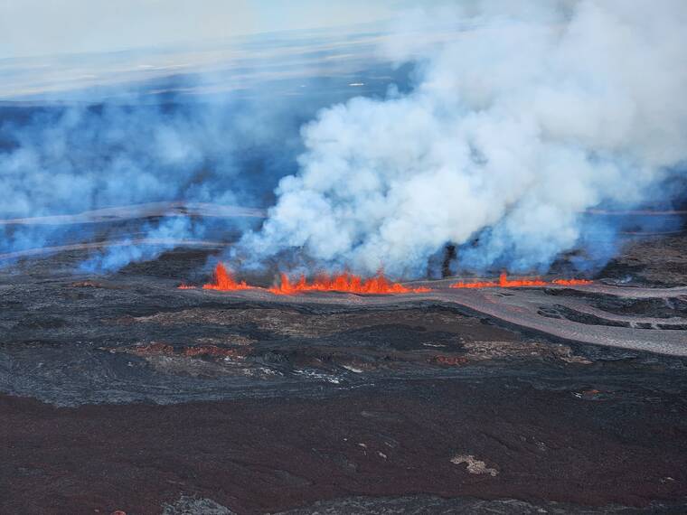
Mauna Loa eruption cuts access, power to Mauna Loa Observatory
Lava from the Mauna Loa eruption on Monday night crossed the access road to the Mauna Loa Observatory, knocking out access and power to one of only four NOAA laboratories across the globe that measure atmospheric conditions and monitor carbon dioxide levels.
As of early Tuesday, experts during a morning news briefing said the lava flow from the volcano that began erupting Sunday night was 5-6 miles from Saddle Road, also known as Daniel K. Inouye Highway. Traveling at just under 1 mph, the flow, if it maintains its current speed and direction, could reach the highway later Tuesday or Wednesday morning, said Kenneth Hon, scientist in charge at the Hawaiian Volcano Observatory.
At its current location, the flow closest to Saddle Road is about two miles away from hitting flatter ground, where it is likely to slow and pool, if past eruptions are any indication, Hon said.
Emergency managers at state and local levels of government are working out scenarios in case the highway is overcome by lava, said Hawaii County Mayor Mitch Roth. In a worst case scenario, east-west access across the island is still possible using either the north and south roadways.
“For pretty much everybody, it’s going to be using those other highways to get around,” Roth said.
Still, experts stressed, it’s too early to tell. Volcanic eruptions and lava flows aren’t easily predicted and the scientists haven’t yet gotten close enough to the summit eruption itself to take good measurements.
“Generally, we can look a few days ahead and we really don’t want to go any further than that,” Hon said.
There are ample places for those wishing to view the eruption, said Roth. But parking along Saddle Road is not one of them. Roth issued an emergency order Monday night prohibiting parking along the highway from mile marker 16 to mile marker 31.
Roth said Gil Kahele state recreation area will be open 24 hours, providing parking there, and also there are parking spots along the highway at trailheads.
“What we’re trying to do is have people not park on the highway,” Roth said. “Its a highway. People drive 60 mph; it’s not a safe place to park.”
The county’s two emergency shelters — one in Pahala and one at Old Airport Park in Kailua-Kona — have been closed, as they’re no longer needed based on projected lava flows, Roth said. No one used the Pahala shelter, which had 200 cots, and only four or five people used the Kona one, he said.
“Clearly the danger for the Ka‘u area and Kona area is gone so there really is no need to have a shelter up there any longer,” Roth said.
Officials said there’s no immediate danger to more populated areas to the northeast, such as Hilo.
“We just don’t know what the advance rates of this lava flow will be right now once it hits flat ground,” Hon said. “These lava flows are like ribbons. Even if they impacted a community, it would impact the community in very specific areas.”
Roth and officials at Hawaii Volcanoes National Park see the eruption more as a blessing than a curse, at least for now. Both the Kilauea and the Mauna Loa volcanic activity are visible from the national park in Volcano, said spokeswoman Jessica Ferracane.
The park is open 24 hours and the best times for viewing while avoiding the growing crowds is before 9 a.m. and after 9 p.m., she said. Ferracane estimated several thousand people visited the park Monday and the number was expected to be higher Tuesday, when a cruise ship was expected to be arriving in Hilo.
“The park is open and viewing has been spectacular,” Ferracane said. “This is a wonderful eruption. … This is more than a spectacle; to many people of Hawaii this is a sacred event.”


