Digital map created for Hilo veterans cemetery

PERROY

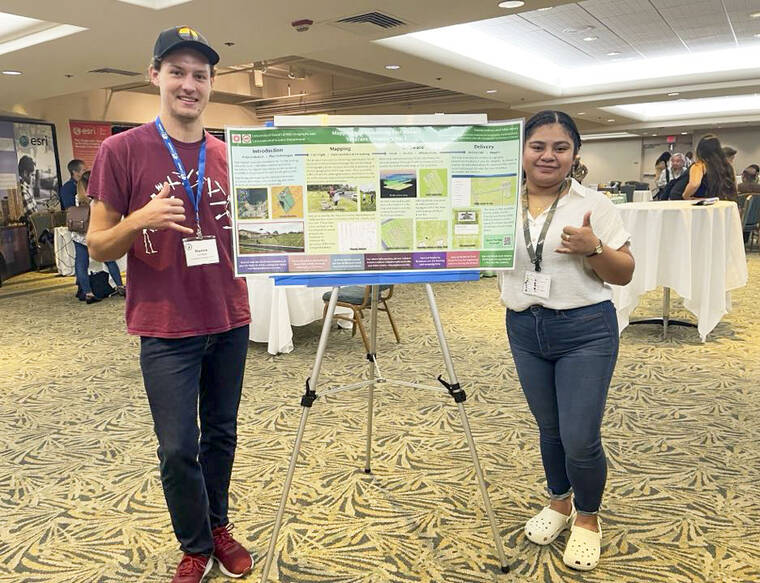
Photo courtesy of Trina Nikki Henry UH-Hilo students Kanoa Lindiwe, left, and Nikki Henry pose for a photo after presenting the East Hawaii Veterans Cemetery No. 1 mapping project during the Pacific Rim Geospatial Conference in 2023.

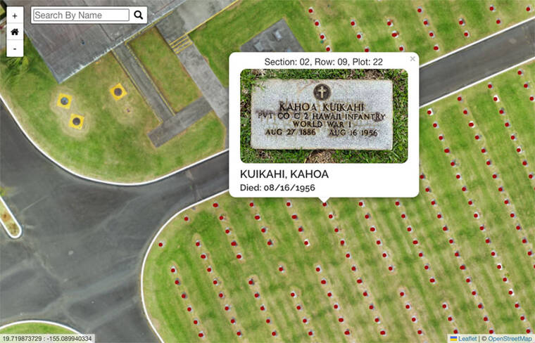
This is a screenshot of the online map of East Hawaii Veterans Cemetery No. 1. The digital map was created by UH-Hilo geography students. Each dot can be clicked, providing the name, section, row, plot number and the date of death of the person at that particular gravesite.

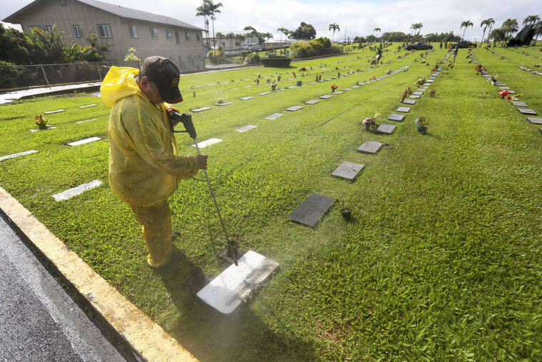
Photo by Kelsey Walling/Tribune-Herald In this 2021 file photo, Steven Angay cleans off a headstone with other members of the Veterans of Foreign Wars Hilo Post 3875 at the East Hawaii Veterans Cemetery No. 1.
Visitors to East Hawaii Veterans Cemetery No. 1 will have an easier time locating the headstones of loved ones thanks to a new digital map created by University of Hawaii at Hilo students.
Visitors to East Hawaii Veterans Cemetery No. 1 will have an easier time locating the headstones of loved ones thanks to a new digital map created by University of Hawaii at Hilo students.
Students studying geography at UH-Hilo got real-life experience in the field when they spent three semesters creating an online plot map designed to help people find specific gravesites at the cemetery.
The online map gives viewers an overhead view of the cemetery, located at 150 Kapiolani St., where they can click on each gravesite or search for a grave by name.
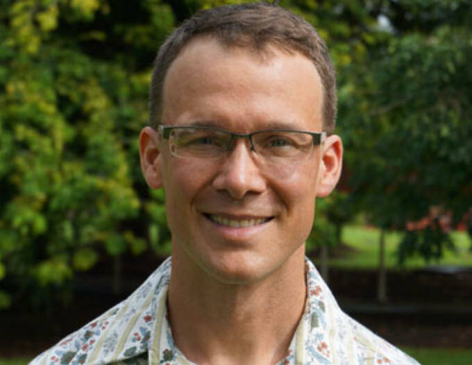
UH-Hilo Spatial Data Analysis and Visualization (SDAV) Laboratory Director Ryan Perroy, who also is a professor of geography and environmental science, came up with the idea for the class project after reading about the lack of maps available for the cemetery, which has caused visitors to spend hours looking for loved ones.
“The hope was that this project would be a way for students to be more in the field addressing community concerns and ultimately giving something back,” Perroy said. “The project is not just a canned exercise, and it has an outcome that’s helpful for folks.”
The Hawaii County Parks and Recreation Department coordinated with the students and Perroy throughout the project and provided them with spreadsheets containing all the available data about the cemetery.
The effort began in fall 2022 as a class project. Students completed the initial fieldwork, which included finding the GPS points and taking pictures of every headstone.
UH-Hilo senior Kanoa Lindiwe, a geography major, and graduate student Nikki Henry spent spring 2023 working to finish the map of the cemetery using photogrammetry and geographic information systems, or GIS, in the SDAV Lab.
“When the class didn’t quite finish the project, Kanoa and Nikki took the project and pushed it forward to make it operational,” Perroy said.
After making sure the order of the headstones was correct, the students used the pictures of the headstones and an overhead drone photo to create an aerial map of the cemetery.
By using GIS, Lindiwe and Henry created “points” and put one on each grave. The points can be clicked by users looking at the digital map, and they will be able to see the photo of that particular headstone.
Through the process, Lindiwe and Henry found there were some errors in the data that needed to be corrected.
“Some of the information we got from the photos of the headstones did not always match the information (the county) provided,” Perroy said. “I believe they are ordering additional headstones due to the work the students did.”
Henry, who is now in the Tropical Conservation Biology Masters program, took a step back from the project after completing her undergraduate degree in spring 2023. Lindiwe took the lead in the fall and focused on the creation of the website and making sure all the information was correct and accessible.
Each grave point contains the name, the section and row location, the plot number and the date of death.
“It was important to make it accessible and add features, like the search option to find people, and to make sure it was compliant with internet standards and reliable,” Lindiwe said. “I was really excited to see the finished product, mainly because I did talk to some people that had experienced trouble finding loved ones in the cemetery.”
The East Hawaii Veterans Cemetery No. 1 is one of 13 cemeteries managed by Parks and Rec, and is a resting place for more than 1,500 fallen soldiers, veterans and family members.
“As we continue to bring our veterans cemeteries up to the standards of the National Cemetery Administration, this GIS mapping of the gravesite locations will ensure that family members and loved ones wishing to visit a gravesite will be able to easily find it,” said Parks and RecDirector Maurice Messina. “We’re appreciative of UH-Hilo for assisting with this project, as we don’t currently have resources in our department for the tremendous undertaking.”
During the past three semesters, Lindiwe, Henry and about 46 other students participated in the project.
“We had a lot of challenges, because we kept realizing we had to do things a specific way, so it was a lot of learning the hard way,” Henry said. “But, we would always come back to do it again, and luckily, we did have a lot of help from many people.”
“I think the best part was the trial and error,” Lindiwe added. “Every time there was a problem, we’d have to figure out a solution, since we knew the end result would benefit the community.”
According to Perroy, more gravesites and new information can be added to the map over time. Other cemeteries also could be added to the the current system.
In April, Lindiwe and Henry will present the project in its entirety during the Association of American Geographers annual meeting, which is taking place in Honolulu this year.
“To be honest, the students have done things I don’t know how to do, and that’s awesome, empowering and exciting,” Perroy said. “The project is going to help people in the community, and in that perspective, it’s a great success.”
While the map has not officially been launched by the county just yet, it is available through UH-Hilo’s website at tinyurl.com/bdzzp47a.
Email Kelsey Walling at kwalling@hawaiitribune-herald.com.


