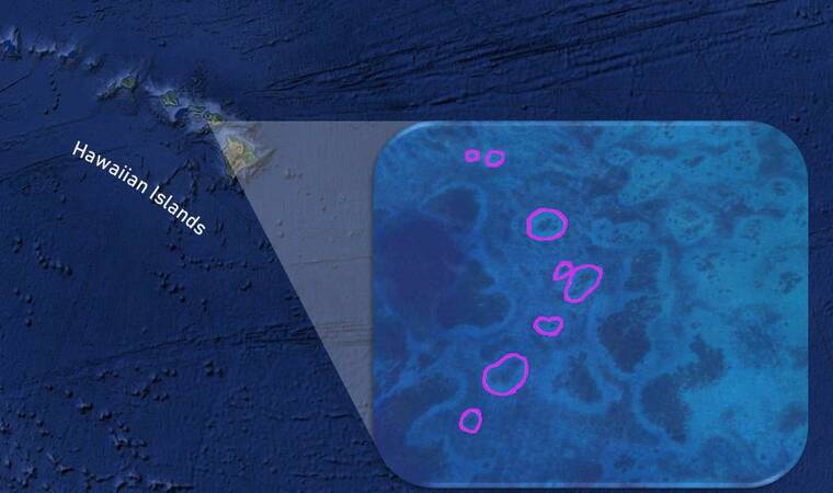
A new coral reef conservation tool has been developed by University of Hawai‘i at Manoa researchers using cutting-edge artificial intelligence (AI) technology. By developing novel deep learning algorithms, coral ecologists in the UH Manoa School of Ocean and Earth Science and Technology (SOEST) are now able to identify and measure reef halos from space. The study was published recently in Remote Sensing of Environment.
These features, also known as grazing halos or sand halos, consist of ring-like patterns of bare sand that occur around coral patch reefs, and their presence is readily visible from satellite images.
“Reef halos may be important indicators of the health and vitality of coral reefs, but until now, their measurement and tracking has been a challenging and time-consuming process,” said Simone Franceschini, lead author of the study and postdoctoral research fellow in the Madin Lab at the Hawai‘i Institute of Marine Biology (HIMB) in SOEST. “However, with this new method, we can accurately identify and measure reef halos on a global scale in a tiny fraction of the time it would take a human being to accomplish the same task.”
Coral reefs, one of the most diverse ecosystems on the planet, upon which many millions of people globally depend, are under threat from overfishing, climate change and many other factors. These ecosystems, and particularly the impact of fisheries and marine reserves on them, are notoriously difficult to monitor at large scales and over time.
“We’re aiming to develop a freely available remote sensing tool to monitor ecological processes over large scales to improve the understanding and management of coral reef ecosystems,” said Elizabeth Madin, the study’s senior author and associate research professor at HIMB. “Our current research shows that reef halos may represent an emerging opportunity to monitor reef ecosystems’ function at large scales, including in remote and otherwise inaccessible areas.”
Improving ecosystem analysis, wildlife conservation
In recent years, computer vision techniques have been increasingly used to recognize patterns in medical and biological studies. In ecology, applications of image analysis coupled with advancements in satellite imaging technology have improved large-scale ecosystem analysis and wildlife conservation.
“This work stems from our team’s understanding of the current state of AI technology and its potential applications for conservation research in coral reef ecosystems,” Madin added.
Although AI technology has shown excellent performance in the field of image analysis, the identification of halos—a complex, ecological pattern with much variation—was a challenge that required combining different deep learning algorithms.
“Reef halos are sometimes very clear in satellite imagery, with distinct edges and high contrast with background vegetation, but sometimes they are quite faint and hard to distinguish—even by a highly trained observer,” Franceschini said. “In the end, our team was able to develop a set of algorithms capable of taking into account the diversity of these patterns globally and identify and measure halos with surprising accuracy. It is hugely satisfying for us to now have built something that can accurately identify more than 90% of halos in some parts of the world.”
Reefs under threat
“This breakthrough is a key step in scaling up—in both space and time—our ability to monitor and quantify aspects of coral reef ecosystem health,” Madin said. “By providing a more efficient and effective way to measure coral patch reefs and their surrounding halos, this new method paves the way for the development of a global-scale reef conservation and monitoring tool based on the phenomenon of reef halos.”
In the near future, the team is aiming to develop a free web app that can allow conservation practitioners, scientists and resource managers to remotely, quickly and inexpensively monitor aspects of reef health using satellite or drone imagery.


