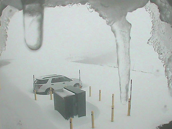
The Maunakea and Mauna Loa summits were blanketed with snow Monday evening amid a winter storm warning that remains posted until 6 p.m. Tuesday.
The Maunakea and Mauna Loa summits were blanketed with snow Monday evening amid a winter storm warning that remains posted until 6 p.m. Tuesday.
Forecasters with the National Weather Service in Honolulu are calling for heavy snow, with accumulations up to 8 inches, and wind gusts up to 45 mph, for the two Hawaii Island summits.
The Maunakea Access Road was closed to the public Monday evening at the Visitor Information Station at the 9,200-foot level elevation.
Forecasters predict that a strong high pressure system northeast of Hawaii and a trough to the southwest will combine to create locally strong southeast winds over Hawaii through the midweek.
Humid air carried by the southeast flow will keep the island “very wet over the next couple of days, with heavy snow over the summits,” the service said.
Rainfall is expected to diminish in the second half of the week.
A flash flood watch continues for Hawaii Island through Tuesday afternoon, as thick clouds moving in from the southeast produce heavy rain, according to the National Weather Service.
The highest threat of flash flooding was in East Hawaii, including the Hilo, Puna and Ka‘u districts.
A high surf advisory remains in effect until 6 p.m. Tuesday for East facing shores of the Big Island.
According to the National Weather Service, strong breaking waves, shore break, and strong longshore and rip currents making swimming difficult and dangerous.


