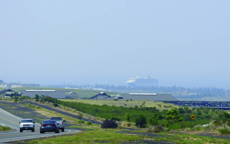
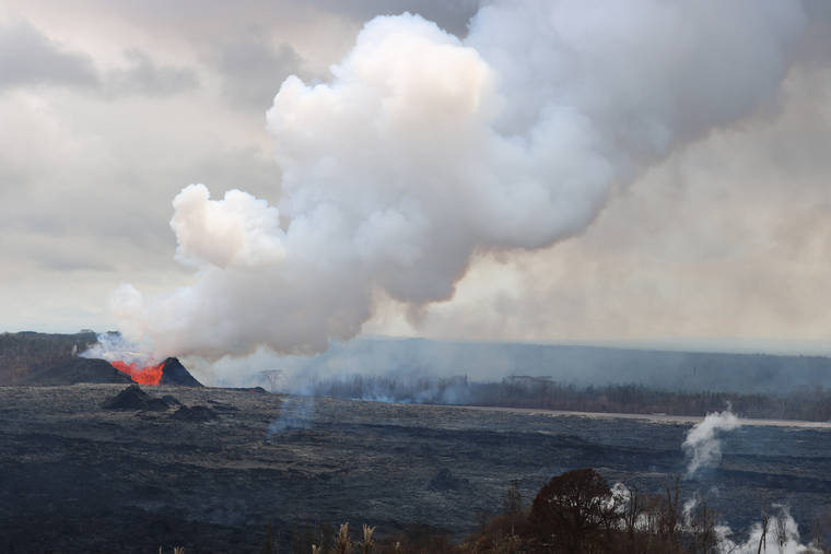
If you were around Hawaii Island — or even other Hawaiian Islands, or Guam — between May and August 2018, you likely know that Kilauea’s lower East Rift Zone (LERZ) eruption released a lot of sulfur dioxide (SO2). But how much is a lot?
Early in the eruption, HVO reported SO2 emission rates of 15,000 t/d (tonnes/day) of SO2. as this was already three times the 5,000 t/d average of the past few years, it seemed very high.
Yet even then, we realized that there was so much SO2 that traditional measurement methods could not adequately quantify the emissions. To measure SO2 emission rates, volcanologists use a device called a spectrometer. The instrument is mounted to a vehicle or aircraft, which passes under the SO2 plume and measures absorption of sunlight by SO2 overhead. The more SO2, the less ultraviolet (UV) light that reaches the spectrometer. in 2018, there was so much SO2 that the spectrometer could barely detect any UV light at all, which made it difficult to determine the exact amount of gas overhead.
Think of it this way — a thin fabric curtain over your window blocks some sunlight. add a second layer of fabric, and more light is blocked. add a third and fourth layer, and it gets darker still. Maybe by seven or eight layers of curtains, no sunlight comes through anymore. at that point, if you added ten more curtains, or a hundred more curtains, it wouldn’t matter—after seven or eight, all the light is already blocked.
That’s the situation we encountered in 2018. We knew that more than 15,000 t/d of SO2 were being emitted, but it was hard to say just how much more.
Luckily, the spectrometer measures UV light over a range of wavelengths. Normally, with low SO2 emissions, we examine wavelengths where SO2 absorption is significant, which allows us to detect even very small amounts of gas. But 2018 was different — essentially no light was reaching the instrument. We then examined a part of the UV spectrum where SO2 absorption is 500 times weaker, so some UV light would still be detectable. Kind of like switching to clear plastic shower curtains to block light at your window. Twenty fabric curtains would block all the light, but 20 clear plastic curtains will still let in light.
The new results were startling! after re-processing all measurements in the new wavelength range, the data revealed that for much of June and early July 2018, fissures in the LERZ emitted nearly 200,000 t/d of SO2.
These are the highest SO2 emission rates measured at Kilauea using the UV spectrometer technique, which began in the late 1970s. Early Puu Oo high lava fountains, and perhaps Mauna Loa’s 1984 eruption, may have had similar emission rates, but those measurements likely suffered from the same underestimation as our initial 2018 analyses. Unfortunately, because of older spectrometer technology, data from the 1980s cannot be reprocessed in the same way as 2018 data.
We now estimate that the 2018 eruption emitted over 10 Mt (megatonnes, or millions of tonnes) of SO2 between May and early August. in those three months alone, Kilauea emitted five times the SO2 it emitted in all of 2017. Few recent eruptions on Earth have released that much SO2, and when they do, they are generally large explosive eruptions at stratovolcanoes.
Most similar to Kilauea’s eruption was the 2014 Holuhraun fissure eruption in Iceland, which also emitted about 10 Mt of SO2, though in six months rather than just three. For comparison, the largest volcanic eruption of the past century, Mount Pinatubo in the Philippines in 1991, only released about twice the SO2 mass of Kilauea’s 2018 eruption, albeit explosively on a single day.
Since the extremely high emissions in 2018 ended, Kilauea has been releasing far less SO2. By late 2018, SO2 emissions were about 30 t/d at the summit and Puu Oo, and near-zero in the LERZ. By early 2019, Puu Oo had dropped to near-zero levels as well. and though some additional SO2 is dissolving into the new lake in Halemaumau Crater, current emission rates are the lowest we have seen at Kilauea in over 30 years of measurements.
Visit https://volcanoes.usgs.gov/observatories/hvo/ for past Volcano Watch articles, Kilauea and Mauna Loa updates, volcano photos, maps, recent earthquake info, and more. Email questions to askHVO@usgs.gov.
Volcano Watch is a weekly article and activity update written by U.S. Geological Survey Hawaiian Volcano Observatory scientists and affiliates.
Volcano activity Updates
Kilauea Volcano is not erupting. its USGS Volcano alert level remains at NORMAL (https://volcanoes.usgs.gov/vhp/about_alerts.html). Kilauea updates are issued monthly.
Kilauea monitoring data for the past month show variable but typical rates of seismicity and ground deformation, low rates of sulfur dioxide emissions, and only minor geologic changes since the end of eruptive activity in September 2018. The water lake at the bottom of Halemaumau continues to slowly expand and deepen. For the most current information on the lake, see https://volcanoes.usgs.gov/volcanoes/kilauea/summit_water_resources.html
Mauna Loa is not erupting and remains at Volcano alert Level ADVISORY. This alert level does not mean that an eruption is imminent or that progression to eruption from current level of unrest is certain. Mauna Loa updates are issued weekly.
This past week, about 120 small-magnitude earthquakes were recorded beneath the upper-elevations of Mauna Loa; most of these occurred at shallow depths of less than 5 miles. GPS measurements show long-term slowly increasing summit inflation, consistent with magma supply to the volcano’s shallow storage system. Gas concentrations at the Sulphur Cone monitoring site on the Southwest Rift Zone remain stable. Fumarole temperatures as measured at both Sulphur Cone and the summit have not changed significantly. For more information on current monitoring of Mauna Loa Volcano, see: https://volcanoes.usgs.gov/volcanoes/mauna_loa/monitoring_summary.html.
There were 4 events with 3 or more felt reports in the Hawaiian islands during the past week: a magnitude-3.7 earthquake 8 km (5 mi) ENE of Pahala at 31 km (19 mi) depth on May 27, 2020 at 02:32 a.m. HST, a magnitude-3.3 earthquake 10 km (6 mi) WNW of Volcano at 6 km (4 mi) depth on May 26, 2020 at 05:55 a.m. HST, a magnitude-3.0 earthquake 7 km (4 mi) ENE of Pahala at 32 km (20 mi) depth on May 25, 2020 at 07:16 a.m. HST, and a magnitude-3.8 earthquake 7 km (4 mi) NE of Pahala at 31 km (19 mi) depth on May 21, 2020 at 12:42 a.m. HST.
HVO continues to closely monitor both Kilauea and Mauna Loa for any signs of increased activity.
