LIVE UPDATES: Tropical Storm warning in effect for Hawaii Island


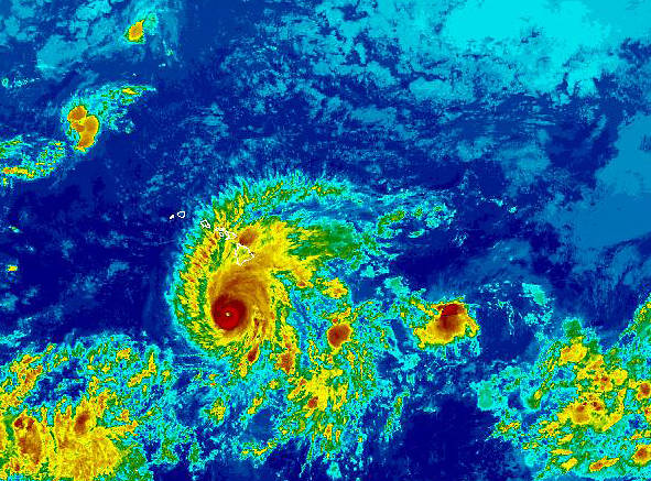
Hurricane Lane remained a Category 4 storm Wednesday evening. (NOAA GOES-WEST/Special to West Hawaii Today)

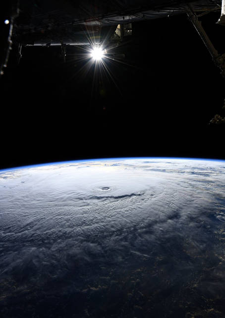
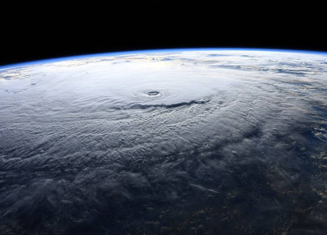
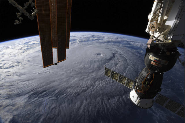
This NASA image shows Hurricane Lane as seen from the International Space Station on Wednesday. (NASA/ via AP)
KAILUA-KONA — Hurricane Lane weakened some this morning as the still-Category 4 storm creeped closer to the Hawaiian Islands.
KAILUA-KONA — Hurricane Lane weakened some this morning as the still-Category 4 storm creeped closer to the Hawaiian Islands.
As of 8 a.m. today, Lane featured 130 mph winds with higher gusts some 205 miles south-southwest of Kailua-Kona and 170 miles southwest of South Point, according to the Central Pacific Hurricane Center. Hurricane-force winds extended outward up to 40 miles from the center of Lane and tropical storm-force winds extended outward up to 140 miles.
The storm was headed northwest at 7 mph. Forecasters expect the storm to make a turn toward the north today. A turn back toward the west is expected Saturday.
Steady weakening is forecast during the next few days, but Lane is expected to remain a hurricane.
Hawaii County Mayor Harry Kim meanwhile stressed Wednesday that West Hawaii residents need to remain vigilant as Hurricane Lane remained on course to pass very close to the Hawaiian Islands.
“I want the residents of West Hawaii to know that, please, the situation is still very uncertain, unstable. There’s a possibility of heavy rain, flooding, and the wind factor is there, but our greatest concern is flooding and damaging surf and surge,” Kim said. “Please remain on the alert.”
The Big Island began seeing Lane’s first effects Wednesday morning with the storm’s outer bands bringing showers to areas of the island. The eastern side of the island picked up nearly 3 inches of rain in three hours, while there was light rain in other areas, like Kailua-Kona.
Current forecast models predict, for the most part, 20-30 mph winds with gusts reaching 55 mph for leeward areas of Hawaii Island. The potential remains for winds to reach up to 73 mph in area. Rainfall accumulations are expected to range from 4 inches to 2 feet, depending on the area.
For Kailua-Kona, the center said there’s a 30 percent chance of 39 mph winds, 7 percent chance of 57 mph winds and a 2 percent chance of hurricane-force winds of 74 mph or higher from 4 a.m. to 4 p.m. today. During the following 12 hours, there’s a 6 percent chance of 39 mph winds, 5 percent chance of 57 mph winds and 1 percent chance of 74 mph winds.
A hurricane warning remained in effect for Hawaii and Maui counties and Oahu while a hurricane watch was posted for Kauai and Niihau as of press time Wednesday.
A high surf warning is also in effect until 6 a.m. Friday for south-facing shores of Hawaii Island. Wave heights of 15 to 20 feet are forecast. A storm surge of up to 4 feet is anticipated.
Should the storm pass Hawaii Island, leaving it relatively unscathed, and hit other islands, Kim said Hawaii County is ready to assist its brothers and sisters across the state.
“That’s an always – that is an always,” Kim said. … “All counties lay hand to each other, that would be an automatic.”
Meanwhile, Hawaii Army National Guard soldiers were sent to Kona Wednesday afternoon out of precaution, Kim said. The troops had been stationed in Puna amid Kilauea Volcano’s lower East Rift Zone eruption.
“We’ve moved the National Guard there because we’re still trying to make a decision in regards to should any of the projected possibilities materialize we need to act before then,” Kim said. “That decision (to act) has not been made, but it is a possibility.”
The troops will assist in any manner requested, from mass evacuation to traffic control, Kim said.
“They will be there and await requests of specific assignments,” he added.
Hawaii County Civil Defense also announced the opening Wednesday of emergency shelters in North Kohala, South Kohala, North Kona and South Kona due to the potential effects of Hurricane Lane. No mandatory evacuation was ordered.
The following shelters were open as of press time: Konawaena High School Gym; Hookena Elementary School; Kamehameha Park Hisaoka Gym (pet friendly); Kealakehe High School (pet friendly); and Waikoloa Elementary & Middle School.
Also Wednesday, Gov. David Ige said President Donald Trump approved a request for emergency aid as the cyclone made its approach Wednesday. The declaration means Hawaii will have easy access to federal resources as communities recover from any damage or losses caused by the hurricane.
Ige and Kim on Tuesday signed emergency proclamations for the state and county, respectively.
Though the storm loomed, the seriousness of the day was briefly interrupted Wednesday morning when staff surprised Kim with a cake and candles to celebrate his 79th birthday.
“Today was one of my funniest days ever in a long time,” he said, noting that the governor and others wished him a happy birthday during the conference.
Public schools, charter schools and libraries are closed for the rest of the week. Also closed are county beach parks from South Point to Mahukona in North Kohala, as well as South Point. In addition, all nonemergency county operations are suspended today. Hele-On bus service will continue today.
^
Closures:
– All public schools and DOE offices in Hawaii and Maui counties will be closed through Friday, according to the state Department of Education. All after-school activities programs are also canceled through the weekend. Schools and offices will reopen Monday unless otherwise noted.
– All public charter schools will be closed through Friday.
– All Kamehameha Schools campuses, preschools, community education programs and offices statewide will be closed through Sunday. KS will resume operations on Monday.
– All county offices are closed today.
– Hawaii County officials have closed all beach parks, from South Point to North Kohala, until further notice. All pavilion and camping permits have been canceled. South Point Road, from its junction with Kamaoa Road to South Point, is closed to all traffic.
– All state parks will close this morning, the Department of Land and Natural Resources said.
– All public libraries will also be closed through Friday. In addition, all library programs statewide scheduled from today to Sunday were canceled.
– State offices on the Big Island and Maui will be closed today through Friday.
– Courthouses on the Big Island will be closed today through Friday.
– All University of Hawaii campuses will be closed through Sunday.
– The Kahuku unit of Hawaii Volcanoes National Park will be closed today. All programs are canceled.
– Puukohola Heiau National Historical Site is closed until further notice. Park managers will assess conditions Saturday morning before reopening the park.
– Puuhonua o Honaunau National Historical Park is closed today. Park managers will assess conditions Friday morning before reopening the park.
– Kaloko-Honokohau National Historical Park is closed today. Park managers will assess conditions Friday morning before reopening the park.
– All branches of Hawaii Community Federal Credit Union are closed due to severe weather.
– The Kona-Kohala Chamber of Commerce office will be closed today. The office plans to reopen Friday or Monday, depending on the storm’s impact.
– The Maunakea Access Road is closed at the Visitor Information Station until further notice.
-Akoni Pule Highway is closed due to a landslide near mile marker 24 in North Kohala.


The satellite imagery shows it’s losing a bit of definition, and it’s almost to 57.5 degrees longitude, while not even half way from 15 degrees north, where it was hanging out. That puts it already about a 100 miles west of us, and it’s got nearly 150 miles north to get here. The NHC track still shows it passing us within about 100 miles offshore, but to get there it shows a little jog back to the east this morning. I don’t know about that, doesn’t seem likely.
Seems we’ll get a lot of rain, some of it needed, and possibly some heavy northeast winds due to the pressure differential, like Darby. But damage from the storm itself? Kinda looks like West Hawaii gets a pass. It’s a big storm, but we should be on the outer edge of the tropical force wind field, if that.
I don’t know where some of the info in this article came from. When I look at the Central Pacific Hurricane Center’s website, it shows a 70% chance of 39 mph winds, not 30%; and a 20% chance of 57 mph winds, not 7%. This is current info as of 8AM this morning.
Since midnight the tracking chart has predicted a nearly due north course for the hurricane yet several reports later (8 hours,) it is still tracking Northwest and creating a near contortion in the track. Is this the model or is the model broken and someone is just moving around a few of the pins on the map to make it look nice?
The GEOS satellite picture just isn’t showing that extreme northern direction that would be necessary to do us great harm. The last shot showed the storm still not quite half way north and yet it was already over the 57.5 degree line, which is roughly 100 miles west of the island. That means unless the storm moves no farther west, it will pass maybe 125-150 miles away. That’s not going to put us in the tropical storm wind field. Still, northeast winds could be pretty fierce, Darby knocked down a tree, not from the storm, Mauna Loa blocked that, but from the pressure differential.
I had to laugh, there are a couple of government employees blocking the street down to the shoreline. They’ve been there since yesterday. The storm won’t even be here until tomorrow, and even then, many miles offshore. Ah well, those guys are causing doing less harm doing nothing than whatever the county would be having them do on a normal day.
And that’s the end of this one. About the worst you can expect is what you’re seeing right now, gusty northeast winds due to the large low pressure to the southwest. Some trees down? The power goes out? Sure, possible. Big time damage from the storm? Zero. It’s just awful difficult for the west side to get hit, the storm track would have to be exceedingly weird to miss Mauna Loa and hit us. This one was about as close as you’ll ever see quite possibly.