HILO — The lava flow in lower Puna is not only changing the landscape, but the seascape, too, impacting the water and sea life within.
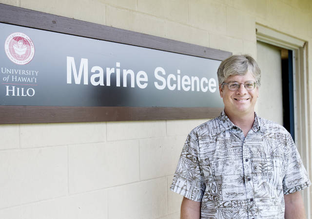
Steven Colbert, an associate professor with the University of Hawaii at Hilo’s Marine Science Department, said he had been doing “quite a bit of work” in the tide pools near Vacationland that were lost to the lava earlier this summer.
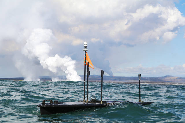
The focus of his research has been on the impacts of freshwater on coastal ecosystems. But with the eruption and subsequent lava ocean entry, Colbert said he’s been collaborating with Liquid Robotics in Kawaihae Harbor on the use of their Wave Glider technology, to help understand the distribution of the hot water from where the lava is entering the ocean and how that’s changing through time.
“The Wave Glider is kind of like a robot that’s out there, and it’s been … monitoring the conditions out there over the last three weeks,” he said Thursday. “It’s a great data set, because without some kind of unmanned device out there, it would have been very difficult to collect this data otherwise.”
The device is roughly the size of a stand-up paddle board, but slightly thicker to hold batteries, a computer for navigation and communication and instruments for science, Colbert said.
“By using this unmanned technology, scientists have the rare opportunity to study the effects of the lava entering the ocean, the plume it creates, and the interactions of the lava and seawater directly from the surface of the ocean,” according to a June announcement from Liquid Robotics. “Scientists note that very few volcanic eruptions and lava flows have ever been monitored in real time from the ocean.”
Colbert said they’ve looked at three different aspects of the data: water temperature, sediment and pH levels.
“The first thing is the temperature of the water, because the water is simply so hot out there,” he explained.
Water is boiling right where the lava enters the ocean, and researchers are observing temperatures greater than 100 degrees two miles off the coast, Colbert said.
Some days, that distance may be farther, while other days not so far.
“How much hot water there is out there seems to fluctuate day by day and (is) partly related to how much lava is pouring into the ocean,” Colbert said.
The background, or “normal,” water temperature while they were sampling was 79 degrees, he said.
“One of the neat things we’ve seen is that hot water tends to flow away from the shoreline,” Colbert said. “It doesn’t tend to spread out along the shoreline, in that as the lava comes in, it makes the water hot, (and) that hot water has to move some place. It moves off shore, and cool water is either coming in along the shoreline or coming up from (the) depths to replace the water where the lava pours in.”
It’s like a “conveyor belt of water,” he continued, which provides “a bit of protection for the ecosystems surrounding the lava flow.”
Another observation is that the water is “very muddy,” he said.
“As the lava pours in, it cools and it cracks and it pops. It basically breaks down into smaller and smaller pieces as the lava cools and gets broken up by waves,” Colbert said.
It produces “lava bombs,” rocks, and fine bits of silt and clay, he said, and the small particles stay suspended.
Colbert said the water looks like “Hilo Bay after after a big rainfall — the water is that muddy.”
The third measurement is the pH, or the alkalinity or acidity, of the water.
Ocean water is “slightly basic” at a pH 8, and pH 7.2 is the lowest that’s been measured, he said. A 7.0 on the pH scale is neutral.
Colbert said the pH levels have been a concern to some, but “in terms of affecting the coastal ecosystem, it’s less important. The heat and sediment in the water are going to have much bigger impacts on those near-shore ecosystems.”
This is the first time in decades this kind of data has been collected. The last such effort was done in the late 1980s or early 1990s by a group at UH-Manoa, according to Colbert.
“One of the big differences is that this lava flow has so much more lava pouring into the ocean, compared to when they were out there,” Colbert said.
Other advantages come thanks to technological advances in the intervening years.
With the Wave Glider, Colbert said measurements are taken every two minutes, providing “high resolution data that simply wasn’t available back then.”
Impact to the water also means impact to the marine life there.
Misaki Takabayashi, a marine science professor at UH-Hilo, said she is a coral biologist by training, “and my student researchers and I have been monitoring the health of coral reefs around Hawaii Island for the last 15 years.”
In Kapoho, particularly, Takabayashi said she had been monitoring 48 coral heads in the Wai‘opae Tide Pools once a month for the past 12 years.
The tide pools were an example of how scientists, educators from UH-Hilo, the Department of Land and Natural Resources, and members of the neighboring Vacationland community “came together for the common cause of marine conservation,” she said.


