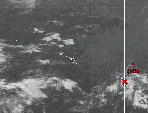
KAILUA-KONA — Forecasters are keeping a close eye on an area of disturbed weather about 950 miles east-southeast of Hilo.
Showers and thunderstorms associated with the low-pressure system became less organized Monday, according to the Central Pacific Hurricane Center.
Environmental conditions are expected to become less conducive for the development of a tropical depression as wind shear increases and the system continues to track westward.
Because the weather system is already in the Central Pacific basin, which runs from 140 degrees west longitude to the International Dateline, if it develops into tropical depression, it would mark the first tropical cyclone of the 2018 Central Pacific hurricane season.
Forecasters gave it a 50 percent change of becoming a tropical cyclone within 48 hours.
Elsewhere in the Central Pacific, no tropical cyclones are expected through the next five days.
NOAA’s Central Pacific Hurricane Center in Honolulu said in May that three to six tropical cyclones — a category that includes depressions, storms and hurricanes — are expected to pass through the basin this year, according to the center. The season continues through Nov. 30.
The basin, which normally sees four to five cyclones develop, spans an area north of the equator from 140 degrees west longitude to the International Date Line. The number of storms has ranged from zero, most recently as 1979, to as many as 11 in 1992 and 1994.
In the center’s outlook, forecasters said there is a 40 percent chance of both an above-normal season and normal season, and a 20 percent chance of a below-normal season.
Named Central Pacific tropical cyclones for 2018 will begin with “Walaka,” according to the center.


