Major Kahaluu development draws concerns
KAHALUU — For generations, the Kahulamu family has laid their loved ones to rest at the family cemetery in Kahaluu.
Mitchell Fujisaka’s father is buried there, as are his grandparents, great-grandparents as well as numerous extended family members, the 80-year-old said at the site Thursday.
And that’s just what’s been marked by headstones.
Even the oldest grave markers don’t convey the full history of this site, which the Kahulamu family has used “from way back then till now.”
“The thing is what you see on top here is marked,” he said, surrounded by memorials. “But you don’t see what’s underneath. So it’s grave on top of grave, burial on top of burial.”
Fujisaka said he’s also been told of burials in a lava tube that runs just below the property.
“And we still bury people,” said Gerry Kahulamu, adding that the family still puts cremated remains on the property.
For Fujisaka, it’s important to keep the family together.
“If I take my grandfather, I bury him in Hilo for instance, my grandmother is here,” he said. “When I come to visit my grandmother, I neglect my grandfather. I go to Hilo, I visit my grandfather, I neglect my grandmother.”
“Here, they’re together,” he said. “I can put my hands on both.”
But the cultural and historic importance of Kahaluu, the ahupuaa just north of Keauhou and location of the popular Kahaluu Beach Park, extends beyond the gates to the family cemetery. There are burials and significant sites all throughout the area, they said.
“There’s burials that nobody knows,” Fujisaka said. “As long as there’s soil, you know there’s gotta be something in there.”
306-unit development
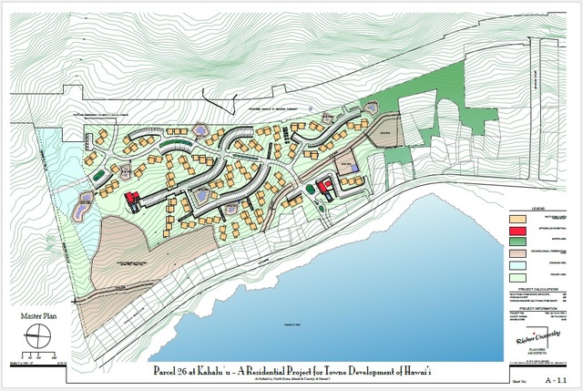
But family members and another Kahaluu resident say cultural sites here are under threat from a proposed 306-unit condominium development planned by Ocean Villas at Kahaluu Bay LLC. The current plan is to develop and sell the units as timeshares, according to the final environmental assessment, but could be sold as whole units depending on the market.
In the final environmental assessment for the project, the applicant is identified as “Towne Development of Hawaii Inc.” The applicant for the special management area permit is identified as Ocean Villas at Kahaluu Bay LLC in planning commission documents. Both companies are listed at the same mailing address, according to the Department of Commerce and Consumer Affairs.
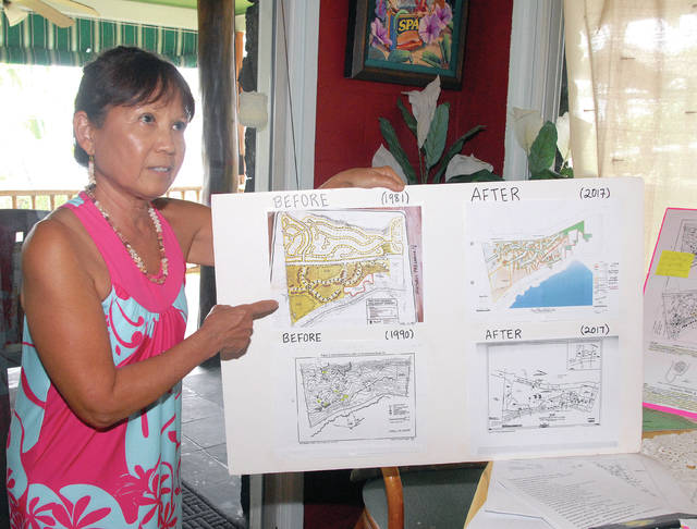
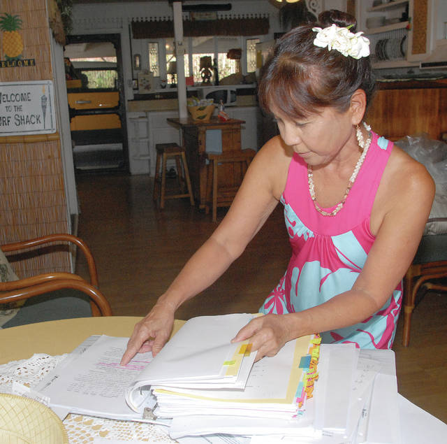
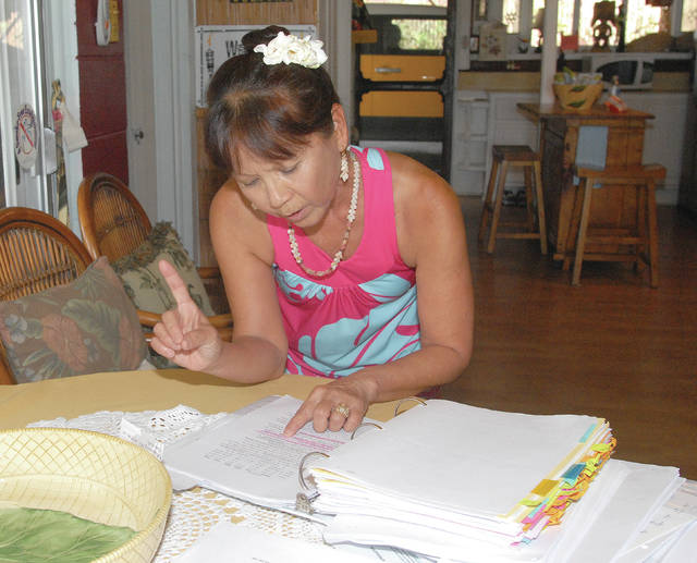
Plans for the development have led to a contested case — with a hearing scheduled to start Monday — from Kahaluu resident Simmy McMichael, whose property borders the proposed project area.
“This place is really spiritual and I never knew how spiritual it was, because I never knew what was back there,” McMichael said at her property Thursday. “And I just knew; I had the feeling that it was special. And when I found out how special, I said, ‘I can’t; I cannot be quiet.’”
The county’s Leeward Planning Commission has reserved two days for the hearing — and a third if necessary — at the West Hawaii Civic Center. Monday’s hearing will start at 8 a.m.
The commission granted McMichael’s petition for a contested case hearing last April at a packed commission meeting in which more than 30 people testified.
In her petition, McMichael said she has “a deep concern for the proper development of land,” noting that the area is part of the Kahaluu Historic District, which is registered in the National Register of Historic Places.
The historical and cultural resources in the project area haven’t gone unacknowledged by the developer. A final environmental assessment for the project cited a survey that found 58 sites consisting of 247 features, which include platforms, mounds, a burial crypt and a petroglyph among others.
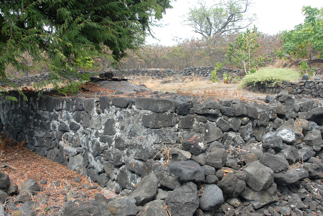
The sites also include the Great Wall of Kuakini, constructed by the first royally appointed governor of the island, according to the assessment. The wall was built in the first half of the 19th century to keep cattle from destroying agricultural plots in the area.
All 58 sites identified were deemed significant but only some sites, including the wall and those inferred to be a burial or possible burial, were marked for preservation, while others were marked for “data recovery.”
To accommodate the 20 sites to be preserved, the project has carved out preservation areas from the project site and are indicated on proposed maps of the development. They include a “north preservation area” as well as the locations of other significant sites — including segments of the Great Wall of Kuakini — that will also be preserved.
The remaining 38 sites, including some inferred to have been used for agriculture and habitation, face “controlled destruction,” which “will be monitored to ensure that significant data is collected, if encountered,” the assessment states.
The assessment also outlines procedures for any archaeological remains or burials uncovered during future phases of the development.
But McMichael argued that the area can’t be split up into individual parts.
“It’s not just sites (and) burials,” she said. “It’s landscape. You have to respect that that was the way Hawaiians lived.”
She argued developers can’t “piece it out.”
“To me it’s like if you take the veterans’ Memorial Park, do you strategically try to put buildings in between?” she asked. “Where’s the respect?”
Some burials not well known
The assessment states that despite a thorough surface survey, no unaccounted for burials have been identified, nor were any cave openings that could lead to a burial.
But Fujisaka argues the secrecy of burial sites was key to the traditions surrounding the practice.
“The only one that knows where that person’s gonna be buried are the people that are assigned,” he said.
The idea that everyone is buried in a cave, he said, is a myth.
“No, no, that’s wrong,” he said. “If that person was familiar with a tree or a rock or something, they would take that person and bury him there or bury her there.”
Fujisaka said what he wants to see are cultural archaeological studies that apply extra analysis to the area.
“What was here? What was it for? What is under the ground here?” he asked.
But, he said, that doesn’t seem to be of interest to developers.
“It’s just like you say, ‘Let’s cover this up and forget about it,’” Fujisaka said.
“They don’t care about the culture,” argued family member Gerry Kahulamu. “All they care about is the money they’re going to make and then they’re going to go back to the mainland. They’ve got dollar-sign eyeballs.”
Concerns addressed
Bill Moore, a planning consultant for Towne Development, pushed back against the notion that the developers haven’t been sensitive to cultural concerns.
The area eyed for development, he said, has been part of the county’s general plan for resort developments since the plan’s adoption.
“The zoning is appropriate,” he said. “We have done all of the archaeological studies and requirements that have been placed on us by the State Historic Preservation Division, so I do take exception that we do not have concern for the historical and cultural sites.”
When the final environmental assessment for the project was published, the section dedicated to mitigating the impacts of the project included an additional five bullet points addressing the handling of cultural sites at the development site beyond what was included in the draft report.
Those points referenced the Kahulamu family, the cemetery site and burials not recorded in the initial inventory survey.
In response to concerns about the development’s proximity to the family cemetery, Towne Development revised its plan to create a “buffer area” around the family’s property.
With that buffer in place, there won’t be any development activities within 150 feet north of the Kahulamu kuleana lands, nor will there be any development activities in any part of the Towne property south of Kahulamu property.
“This measure ensures that construction will not take place near to the Kahulamu graveyard and will not encroach upon or diminish the character of those burials,” stated the assessment.
In sum, the assessment said, the revised plan includes almost 19 acres as either permanent preservation areas and open space, including the buffer.
Gerry Kahulamu said she hadn’t seen anything about the proposed buffer in writing but that it wouldn’t change her position.
“Personally, I don’t want to see any development,” she said. “This isn’t the area. It’s already too crowded.”
Fujisaka agreed.
“No,” he said, “no as in no, absolutely no, any other way it comes out, it’s no,” he said. “I am against it.”
Fear of more Alii Drive traffic
Also of concern to some in the area is the impact new development could have on local infrastructure.
The development makes repeated reference to the proposed Kahului to Keauhou Parkway, which would run immediately mauka of the development.
Once built, that road would become “the major access to the development,” according to the final environmental assessment.
The developer has proposed driveway connections to the proposed parkway or to a mauka-makai road north of the project site.
“However,” the assessment states, “there is no schedule of completion for these long-planned projects.”
Until that road becomes a reality, traffic associated with the project would enter and exit via a driveway to be built through a vacant lot on Alii Drive and connect to the development’s makai side through an existing breach in the Kuakini Wall.
Towne Development has proposed the possible development of an emergency access route to Laaloa Avenue, which would offer alternative mauka-makai access during emergencies.
Some in the area though are concerned expanded use of Alii Drive could snarl traffic further.
“We don’t have the highway,” said McMichael, referring to the planned parkway. “We may never have the highway, because there are burials.”
McMichael in her petition argued that the assessment and application assume the parkway will be built “and, therefore, the timing of the project is premature and the application should not be considered until such time as the parkway is constructed,” she wrote.
In a letter opposing the development Gerry and Willy Kahulamu raised the traffic issue among their concerns, saying it’s taken as long as 10 minutes just to get out the driveway.
“When surf’s up, it’s wall to wall cars looking for a parking spot,” the letter said. “Add all the surf schools and their clients and it’s just ridiculous!”
Numerous other area residents also identified traffic as a big concern about the proposed development.
McMichael also referenced a letter from the county’s police department that said traffic congestion stemming from the development would be “the main concern.”
In reviewing the draft assessment, the department noted that the developer would prepare for future road infrastructure but it wouldn’t be in place by completion of the project.
They therefore asked that the developer be required to complete additional infrastructure before the development “as inadequate roadways for a development this size would hinder or cause a bottle neck type of situation should the need for emergency evacuation arise.”
In responses to those concerns included in the final environmental assessment, Ron Terry of Geometrician Associates mentioned the proposed Laaloa Avenue connection and the use of the parkway right-of-way as a potential emergency evacuation route.
Furthermore, the assessment reports that the development wouldn’t have the disastrous impact some allege.
An analysis included in the report found that the driveway would operate at the best possible level as measured by the analysis, concluding that traffic turning into the development “will have a minimal impact on northbound and southbound traffic flow along Alii Drive.”
The report does acknowledge that traffic along that road “becomes very congested” on high-surf days and “turning movements into any driveway or street further delay traffic.”


