KAILUA-KONA — A cruise ship scheduled to make a call in Kailua-Kona Wednesday was unable to do so as a result of high, unusual winds associated with a weather system to the west. ADVERTISING KAILUA-KONA — A cruise ship scheduled
KAILUA-KONA — A cruise ship scheduled to make a call in Kailua-Kona Wednesday was unable to do so as a result of high, unusual winds associated with a weather system to the west.
The winds, coming from the south, are associated with a surface low pressure system centered about 100 miles northwest of Kauai, said Tom Birchard, a meteorologist with the National Weather Service.
That system has already been dropping lots of rain throughout the rest of the state.
East of that system, Birchard explained, is a line of heavy showers and thunderstorms which have mostly been affecting the islands from Kauai to Maui.
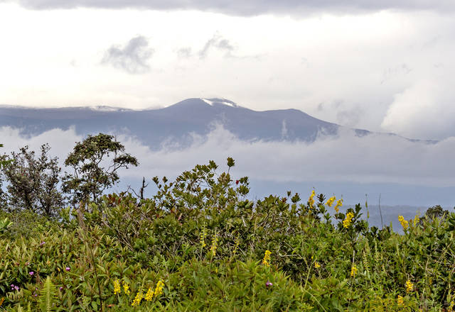
On the Big Island though, he said, the primary impact has been to the upper slopes of Mauna Kea.
“Thus far, the amount of rain and precipitation at the lower levels on the Big Island is nowhere near as the amount we’ve seen on the other islands,” he said.
But it is having the effect of winds that are coming in from the south.
“Anytime we have winds out of the south, it’s unusual,” said Birchard.
A lot of the harbors and the like are built for tradewinds, coming from the east. When the wind comes from the south though, lots of places become exposed, resulting in “weird accelerations in different places.”
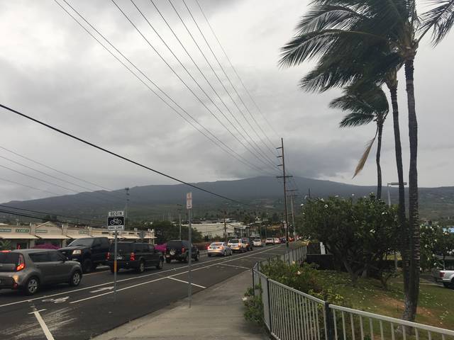
For example, at about 2 p.m. Wednesday, he said, sustained winds at Kona International Airport at Keahole were measured at 22 mph with gusts at about 33 mph.
He likened it to places like Upolu Point and South Point, which are typically windy from easterly tradewinds.
“So Keahole’s kinda become like Upolu or South Point today with this wind direction,” said Birchard. “It’s normally the trades are blasting at Upolu and South Point, now we’ve turned the winds 90 degrees to the south, so they’re accelerating around Cape Kumukahi (in Puna) and in Kona.”
Wednesday morning, Norwegian Cruise Line’s Pride of America was unable to make its scheduled call because of the high winds, said Vanessa Picariello, senior director of public relations at Norwegian Cruise Line.
“The safety and security of our guests is our top priority at all times,” she said. “The high winds in Kona today made for unsafe tendering conditions and, therefore, the vessel was unable to make her scheduled call.”
The cruise line was also unable to stop in Kona once last month because of high swells, she added.
As the weather system moves on, Birchard said, southerly winds remain a concern, having the potential to bring locally gusty winds to the area.
And while it’s generated some windswell coming into south shores, he said, it’s probably not so much the case for the Big Island — more for islands toward the west.
“But not significantly, we don’t think,” he said, “not enough to produce significant surf.”
By tonight going into Friday, he said, the winds should become much lighter.
One big remaining question in the forecast, Birchard said, was whether the line of showers would drift over the Big Island to bring rainfall to lower elevations.
While heavy showers aren’t a certainty, Birchard said what was certain was continued snow and winter weather on the Mauna Kea summit.
“That’s going to continue through (Wednesday) night,” he said.
Exactly how much snow was expected to fall is hard to tell, he added. With winds blowing at 40-60 mph up there, it’s tough to get reliable reports on how much is blowing around and how much is actually falling.
“We can say significant amounts of snow,” he said, “and still a significant snow threat overnight. With blowing snow and visibility reduced to near zero, (that) warrants the continuation of a blizzard warning for the summit.”
The threat of rainfall, he added, was likely to diminish over Wednesday night.


