Geologists find tsunami hazard in eastern Aleutian Islands


ANCHORAGE, Alaska — Geologists in Alaska have found evidence that a 125-mile section of the eastern Aleutian Islands that was once considered unlikely to generate earthquakes may be a future source of temblors — as well as potentially devastating tsunamis that could hit Hawaii.
Field work by U.S. Geological Survey scientists on Sedanka Island near Dutch Harbor, a major U.S. fishing port, revealed “sand sheets,” or deposits of sand lifted off beaches and moved a half-mile inland. The sand sheets indicate large tsunamis had hit frequently — in geologic time.
“This is the first Aleutian study to report evidence for prehistoric tsunamis, and the recurrence intervals are in geologic perspective very short at 300 to 340 years,” said USGS geologist Rob Witter.
The Aleutians, stretching about 1,200 miles, are part of a subduction zone where two great tectonic plates collide. The Pacific Plate, beneath the Pacific Ocean, is slowly being subducted, or pushed below, the North American Plate that covers most of North America.
Prevailing models show that friction locks up the two plates, and elastic energy builds until the strain is too great and there’s an earthquake. The largest releases in the form of megathrust earthquakes shift hundreds of miles of earth and create devastating tsunamis.
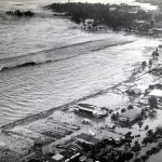
A 1946 earthquake 90 miles south of Unimak Island in the eastern Aleutians stopped before it reached the area near Dutch Harbor. The earthquake created a tsunami that killed six people in Alaska, including five Coast Guardsman at a lighthouse on Unimak Island, and 159 people in Hawaii.
A 1957 quake tore 745 miles of ground near Adak in the western Aleutians but stopped short of the area around Dutch Harbor. A tsunami took no lives but caused widespread damage in Hawaii.
The 125-mile-long area in the eastern Aleutians has been an enigma, Witter said. It was thought to be over a “creeping” fault where the plates move continuously without building up strain.
A tip from a retired Humboldt State University geologist, Gary Carver, who saw sand sheets on Sedanka Island led to the study by Witter and other researchers. The oldest sand sheet appeared to be deposited 1,700 years ago. The newest was deposited in 1957.
“In this particular area, what’s surprising is that it’s creeping, yet we have evidence for large tsunamis that may have been caused by megathrust earthquakes in the past,” Witter said.
The USGS researchers made no recommendations for earthquake modeling affecting Hawaii, but officials there have used the information to broaden tsunami evacuation zones, Witter said.


