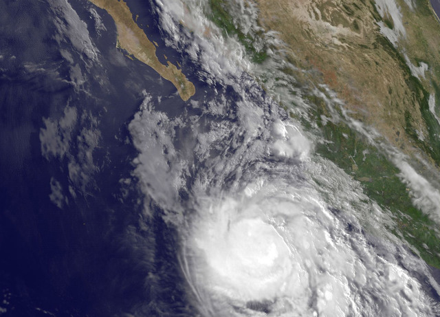
Hurricane Delores was packing 85 mph winds as it churned in waters off the southwestern coast of Mexico Tuesday afternoon. Forecasters expect Delores to near Socorro Island on Wednesday. ADVERTISING Hurricane Delores was packing 85 mph winds as it churned
Hurricane Delores was packing 85 mph winds as it churned in waters off the southwestern coast of Mexico Tuesday afternoon. Forecasters expect Delores to near Socorro Island on Wednesday.
Delores, located 250 miles southwest of Cabo Corrientes, Mexico, is forecast to continue strengthening and should be upgraded to a major hurricane on Wednesday, forecasters with the Miami-based National Hurricane Center said. A major hurricane features sustained 1-minute surface winds of at least 111 mph, or the equivalent of Category 3 storm on the Saffir-Simpson scale.
Tuesday afternoon, the storm was packing 85 mph winds and moving west-northwest at 7 mph. It featured a 20-mile-wide eye and hurricane-force winds extending outward up to 25 miles from the center of the storm. Tropical storm force winds extended outward up to 150 miles.
Forecasters expect Delores to continue strengthening during the next couple of days thanks to warm waters and light vertical wind shear in the Eastern Pacific ocean. It could peak Thursday as a Category 3 storm packing 120 mph winds before starting to weaken later this week as it encounters cooler waters.
Swells generated by the storm, which are already impacting portions of the southwestern Mexico coast, were expected to reach the southern coast of the Baja California peninsula on Tuesday. Forecasters say Delores is likely to pass near Socorro Island, which is located several hundred miles off the Mexican coast, on Wednesday.
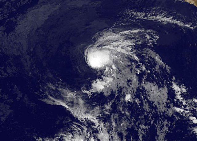
Also being monitored Tuesday afternoon was Tropical Storm Enrique, located 1,365 miles west of the southern tip of the Baja California peninsula. The storm, which strengthened overnight Monday into Tuesday, was packing 50 mph winds and moving toward the west-northwest at 9 mph.
The tropical storm is forecast to weaken starting Wednesday as it encounters cooler waters and increased wind shear. It should be downgraded to a remnant low by the end of the week.
Elsewhere in the Eastern Pacific, no tropical cyclone formation is expected through the end of the week.
Meanwhile in the Central North Pacific basin, which is where Hawaii is located, Central Pacific Hurricane Center forecasters continued to monitor the remnants of Tropical Storm Iune located 930 miles southwest of Honolulu. Forecasters said that while isolated thunderstorms are still developing around the low, environmental conditions will likely prevent strengthening appreciably during the next couple of days.
Elsewhere in the Central North Pacific, no tropical cyclones are expected through Thursday afternoon.
The Central North Pacific and Eastern Pacific hurricane seasons continue through Nov. 30.
Get more hurricane-related content, including preparation tips, evacuation info and daily tropical weather updates, on our hurricane season page, sponsored by Clark Realty, at www.westhawaiitoday.com/hurricane-season-2015.


